Results
We found 22 matching items.


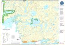
- Brightsand
 CrimeStoppers - North of Superior Explorer Map Series Map housed at the Brodie Resource Library
  CrimeStoppers - North of Superior Explorer Map Series Map housed at the Brodie Resource LibraryThunder Bay Public Library
 - Lac Des Mille Lacs / Dog River
 CrimeStoppers - North of Superior Explorer Map Series Map housed at the Brodie Resource Library
  CrimeStoppers - North of Superior Explorer Map Series Map housed at the Brodie Resource LibraryThunder Bay Public Library
 - Black Sturgeon
 CrimeStoppers - North of Superior Explorer Map Series Map housed at the Brodie Resource Library
  CrimeStoppers - North of Superior Explorer Map Series Map housed at the Brodie Resource LibraryThunder Bay Public Library
 - Lake Nipigon
 CrimeStoppers - North of Superior Explorer Map Series Map housed at the Brodie Resource Library
  CrimeStoppers - North of Superior Explorer Map Series Map housed at the Brodie Resource LibraryThunder Bay Public Library
 - Wabakimi Park
 CrimeStoppers - North of Superior Explorer Map Series Map housed at the Brodie Resource Library
  CrimeStoppers - North of Superior Explorer Map Series Map housed at the Brodie Resource LibraryThunder Bay Public Library
 - Northern Lights Country East
 CrimeStoppers - North of Superior Explorer Map Series Map housed at the Brodie Resource Library
  CrimeStoppers - North of Superior Explorer Map Series Map housed at the Brodie Resource LibraryThunder Bay Public Library
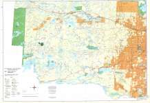
 - Thunder Bay
 CrimeStoppers - North of Superior Explorer Map Series Map housed at the Brodie Resource Library
  CrimeStoppers - North of Superior Explorer Map Series Map housed at the Brodie Resource LibraryThunder Bay Public Library
 - Caribou Lake
 CrimeStoppers - North of Superior Explorer Map Series Map housed at the Brodie Resource Library
  CrimeStoppers - North of Superior Explorer Map Series Map housed at the Brodie Resource LibraryThunder Bay Public Library
 - Sleeping Giant : Interior Trails
 This is verso of the Sleeping Giant Provincial Park Map 208. Housed at the Brodie Resource Library
  This is verso of the Sleeping Giant Provincial Park Map 208. Housed at the Brodie Resource LibraryThunder Bay Public Library
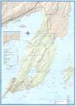
 - Sleeping Giant Provincial Park
 Map housed at the Brodie Resource Library
  Map housed at the Brodie Resource LibraryThunder Bay Public Library
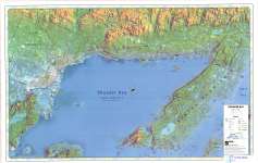
 - Thunder Bay (Lake Superior Gitchee Gumee)
 Map housed at the Brodie Resource Library
  Map housed at the Brodie Resource LibraryThunder Bay Public Library
 - Shuniah Area Rural Roads
 Map housed at the Brodie Resource Library
  Map housed at the Brodie Resource LibraryThunder Bay Public Library
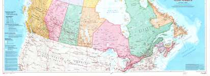
 - Canada (upper half)
 See lower half of map on separate record. The Atlas of Canada Reference Map Series Map housed at the Brodie Resource Library
  See lower half of map on separate record. The Atlas of Canada Reference Map Series Map housed at the Brodie Resource LibraryThunder Bay Public Library
 - Canada (lower half)
 See upper half of map on separate record. The Atlas of Canada Reference Map Series Map housed at the Brodie Resource Library
  See upper half of map on separate record. The Atlas of Canada Reference Map Series Map housed at the Brodie Resource LibraryThunder Bay Public Library
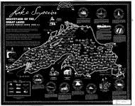
 - Lake Superior : Graveyard of the Great Lakes

 Map housed at the Brodie Resource Library
 Map housed at the Brodie Resource LibraryThunder Bay Public Library
 - Northern Lights Country West
 CrimeStoppers - North of Superior Explorer Map Series Map housed at the Brodie Resource Library
  CrimeStoppers - North of Superior Explorer Map Series Map housed at the Brodie Resource LibraryThunder Bay Public Library
 - Northern Light Lake / Shebandowan
 CrimeStoppers - North of Superior Explorer Map Series Map housed at the Brodie Resource Library
  CrimeStoppers - North of Superior Explorer Map Series Map housed at the Brodie Resource LibraryThunder Bay Public Library
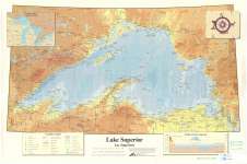
 - Lake Superior : Lac Superieur
 Map housed at the Brodie Resource Library
  Map housed at the Brodie Resource LibraryThunder Bay Public Library
 - Washout on the C.N., Rainy River, Ontario
 Aerial, coloured photo showing the washout of railway track near Rainy River, Ontario. This photo was taken around Mine Centre, Ontario.
  Aerial, coloured photo showing the washout of railway track near Rainy River, Ontario. This photo was taken around Mine Centre, Ontario.Thunder Bay Public Library
 - Washout near Rainy River

 Another aerial view of the damage to the railway tracks near Mine Centre, Ontario. Heavy rains in the area caused major flooding in June, 2002.
 Another aerial view of the damage to the railway tracks near Mine Centre, Ontario. Heavy rains in the area caused major flooding in June, 2002.Thunder Bay Public Library

