Results
We found 30 matching items.


- Lake Huron, 1860
 Aids to Navigation corrected to 2 March 1888
  Aids to Navigation corrected to 2 March 1888Maritime History of the Great Lakes
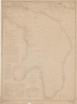
 - Chart of Part of the North Coast of Lake Superior from Small Lake Harbour to Peninsula Harbour [1823, 1861]
 Chart of Part of the North Coast of Lake Superior from Small Lake Harbour to Peninsula Harbour Surveyed by Lieu't Henry W'y Bayfield, R. N. assisted by Mr. Philip E. Collins, Mid'n 1823 NB The Sounds are in feet Magnetic Variation 1892, decreasing about 3' annually. London ...
  Chart of Part of the North Coast of Lake Superior from Small Lake Harbour to Peninsula Harbour Surveyed by Lieu't Henry W'y Bayfield, R. N. assisted by Mr. Philip E. …Maritime History of the Great Lakes
 - Lake Huron. Rattle Snake Harbour [1828, 1863]
 Lake Huron Rattle Snake Harbour by Lieut. H. W. Bayfield R. N. NB The sounds are in feet Variation 1861 increasing 4' annually London Published according to Act of Parliament at the Hydrographical Office of the Admiralty, 3d June 1828. Corr'tns 11861. June 63 J. & C. Walker Sculpt...
  Lake Huron Rattle Snake Harbour by Lieut. H. W. Bayfield R. N. NB The sounds are in feet Variation 1861 increasing 4' annually London Published according to Act of Parliament …Maritime History of the Great Lakes
 - Upper Canada: Plans of Ports in Lake Huron:
Penetanguishene, Collingwood, Goderich
 Georgian Bay Penetanguishene Harbour Surveyed by Lieut. Henry W. Bayfield, R. N. 1822 -- Georgian Bay Collingwood harbour Surveyed by Mr. Wm. Gibbard, C.E. April 1858 -- Goderich Harbour Surveyed by Mr. F. A. Wise July 1861 Lighthouse, Lat. 49. 45' 0 N. Long 81. 41'. W. from Greenwich ...
  Georgian Bay Penetanguishene Harbour Surveyed by Lieut. Henry W. Bayfield, R. N. 1822 -- Georgian Bay Collingwood harbour Surveyed by Mr. Wm. Gibbard, C.E. April 1858 -- Goderich Harbour Surveyed …Maritime History of the Great Lakes
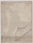
 - Plan of Toronto Harbour, Lake Ontario [1863]
 Although based on the 1817 chart, this edition is substantially revised. The streets and wharves of the city of Toronto have been completely redrawn to reflect the new wharves and the infilling of the waterfront. The shoal around Gibraltar Point has been reconfigured, and shows the buoys at the Western …
  Although based on the 1817 chart, this edition is substantially revised. The streets and wharves of the city of Toronto have been completely redrawn to reflect the new wharves and …Maritime History of the Great Lakes
 - Lake Huron. Georgian Bay [1822, 1864]
 Modifications to the original chart include lights and some place names.
  Modifications to the original chart include lights and some place names.Maritime History of the Great Lakes
 - Survey of Mohawk Bay, Lake Erie [1828, 1861]
 This edition added the light on Mohawk Island.
  This edition added the light on Mohawk Island.Maritime History of the Great Lakes
 - A Survey of St. Joseph's North Channel, Lake Huron [1822, 1865]
 Chart extends from Lake George and Sugar Island in the northwest, Neebish Island and Mud Lake in the south west, St. Joseph Island on the south and east to the bay that would eventually front Bruce Mines.
  Chart extends from Lake George and Sugar Island in the northwest, Neebish Island and Mud Lake in the south west, St. Joseph Island on the south and east to the …Maritime History of the Great Lakes
 - Lake Erie. Long Point Bay [1839, 1863]
 This edition added lights, place names a road and a note about the New Channel silting up in 1862.
  This edition added lights, place names a road and a note about the New Channel silting up in 1862.Maritime History of the Great Lakes
 - Upper Canada: Plans of Ports in Lake Huron:
Penetanguishene, Collingwood, Goderich [1865]
 Georgian Bay Penetanguishene Harbour Surveyed by Lieut. Henry W. Bayfield, R. N. 1822 Magnetic Variation in 1863, increasing 4' annually. -- Georgian Bay Collingwood harbour Surveyed by Mr. Wm. Gibbard, C.E. April 1858 -- Goderich Harbour Surveyed by Mr. F. A. Wise July ...
  Georgian Bay Penetanguishene Harbour Surveyed by Lieut. Henry W. Bayfield, R. N. 1822 Magnetic Variation in 1863, increasing 4' annually. -- Georgian Bay Collingwood harbour Surveyed by Mr. Wm. Gibbard, …Maritime History of the Great Lakes
 - General Chart of Lake Huron, 1860
 SURVEY OF THE NORTHERN AND NORTH WESTERN LAKES Made in obedience to Acts of Congress and under the direction of THE BUREAU OF TOPOGRAPHICAL ENGINEERS OF THE WAR DEPARTMENT GENERAL CHART OF LAKE HURON Projected from trigonometrical Surveys under the orders of Captain G. G. MEADE Topl ...
  SURVEY OF THE NORTHERN AND NORTH WESTERN LAKES Made in obedience to Acts of Congress and under the direction of THE BUREAU OF TOPOGRAPHICAL ENGINEERS OF THE WAR DEPARTMENT GENERAL …Maritime History of the Great Lakes
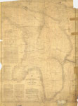
 - Preliminary Chart of Part of Lake Superior, 1868 [Ontonagon to Grand Island]
 SURVEY OF THE NORTHERN AND NORTH WESTERN LAKES. Made in obedience to acts of Congress and orders from THE BUREAU OF ENGINEERS OF THE WAR DEPARTMENT, and under the direction of Brvt. Brig. Genl. W.F. RAYNOLDS, Lt. Col. Corps of Engrs Supt. PRELIMINARY CHART OF PART OF LAKE
  SURVEY OF THE NORTHERN AND NORTH WESTERN LAKES. Made in obedience to acts of Congress and orders from THE BUREAU OF ENGINEERS OF THE WAR DEPARTMENT, and under the direction …Maritime History of the Great Lakes
 - Preliminary Chart of Part of Lake Superior, 1868 [Grand Island to Sault Ste. Marie]
 SURVEY OF THE NORTHERN AND NORTH WESTERN LAKES. Made in obedience to acts of Congress and orders from THE BUREAU OF ENGINEERS OF THE WAR DEPARTMENT, and under the direction of Brvt. Brig. Genl. W.F. RAYNOLDS, Lt. Col. Corps of Engrs Supt. PRELIMINARY CHART OF PART OF LAKE
  SURVEY OF THE NORTHERN AND NORTH WESTERN LAKES. Made in obedience to acts of Congress and orders from THE BUREAU OF ENGINEERS OF THE WAR DEPARTMENT, and under the direction …Maritime History of the Great Lakes
 - North End of Green Bay, the Islands at the Entrance and the N.W. Shore of Lake Michigan, 1864
 Aids to Navigation corrected to 26 Sept. 1897
  Aids to Navigation corrected to 26 Sept. 1897Maritime History of the Great Lakes
 - Saginaw Bay and Part of Lake Huron, 1860

 Maritime History of the Great Lakes
 - Portage Lake and River with Part of Keweenaw Bay, 1865
 Aids to navigation corrected to 4 Jan. 1898
  Aids to navigation corrected to 4 Jan. 1898Maritime History of the Great Lakes
 - Cataraugus Harbor, 1865

 Maritime History of the Great Lakes
 - Huron Bay and Huron Islands, Lake Superior, 1869

 Maritime History of the Great Lakes
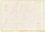
 - Survey of the River Niagara [1817, 1863]
 Survey of the River Niagara. Made under the direction of Capt'n W'm Fitz W'm. Owen, in the Year 1817 The enlarged Plan of the Entrance, & that on the smaller Scale distinguished by upright Soundings, is from the United States Survey corrected to 1856. The Soundings are laid down in …
  Survey of the River Niagara. Made under the direction of Capt'n W'm Fitz W'm. Owen, in the Year 1817 The enlarged Plan of the Entrance, & that on the smaller …Maritime History of the Great Lakes
 - Lake Superior. Sheet 2 [1823-24, 1863]
 This edition adds a significant number of place names, including lights, fishing stations and Hudson Bay Company posts along with additional notes about local magnetic variations. From the American charts have been added insets for Ontonagon, Agate Harbour and Marquette.
  This edition adds a significant number of place names, including lights, fishing stations and Hudson Bay Company posts along with additional notes about local magnetic variations. From the American charts …Maritime History of the Great Lakes

![Chart of Part of the North Coast of Lake Superior from Small Lake Harbour to Peninsula Harbour [1823, 1861] Chart of Part of the North Coast of Lake Superior from Small Lake Harbour to Peninsula Harbour [1823, 1861]](https://images.MaritimeHistoryoftheGreatLakes.ca/images/MHGL000122584t.jpg)
![Lake Huron. Rattle Snake Harbour [1828, 1863] Lake Huron. Rattle Snake Harbour [1828, 1863]](https://images.MaritimeHistoryoftheGreatLakes.ca/images/MHGL000122587t.jpg)
![Plan of Toronto Harbour, Lake Ontario [1863] Plan of Toronto Harbour, Lake Ontario [1863]](https://images.MaritimeHistoryoftheGreatLakes.ca/images/MHGL000122607t.jpg)
![Lake Huron. Georgian Bay [1822, 1864] Lake Huron. Georgian Bay [1822, 1864]](https://images.MaritimeHistoryoftheGreatLakes.ca/images/MHGL000122609t.jpg)
![Survey of Mohawk Bay, Lake Erie [1828, 1861] Survey of Mohawk Bay, Lake Erie [1828, 1861]](https://images.MaritimeHistoryoftheGreatLakes.ca/images/MHGL000122613t.jpg)
![A Survey of St. Joseph's North Channel, Lake Huron [1822, 1865] A Survey of St. Joseph's North Channel, Lake Huron [1822, 1865]](https://images.MaritimeHistoryoftheGreatLakes.ca/images/MHGL000122614t.jpg)
![Lake Erie. Long Point Bay [1839, 1863] Lake Erie. Long Point Bay [1839, 1863]](https://images.MaritimeHistoryoftheGreatLakes.ca/images/MHGL000122615t.jpg)
![Upper Canada: Plans of Ports in Lake Huron:
Penetanguishene, Collingwood, Goderich [1865] Upper Canada: Plans of Ports in Lake Huron:
Penetanguishene, Collingwood, Goderich [1865]](https://images.MaritimeHistoryoftheGreatLakes.ca/images/MHGL000122616t.jpg)
![Preliminary Chart of Part of Lake Superior, 1868 [Ontonagon to Grand Island] Preliminary Chart of Part of Lake Superior, 1868 [Ontonagon to Grand Island]](https://images.MaritimeHistoryoftheGreatLakes.ca/images/MHGL000066599t.jpg)
![Preliminary Chart of Part of Lake Superior, 1868 [Grand Island to Sault Ste. Marie] Preliminary Chart of Part of Lake Superior, 1868 [Grand Island to Sault Ste. Marie]](https://images.MaritimeHistoryoftheGreatLakes.ca/images/MHGL000066601t.jpg)
![Survey of the River Niagara [1817, 1863] Survey of the River Niagara [1817, 1863]](https://images.MaritimeHistoryoftheGreatLakes.ca/images/MHGL000122603t.jpg)
![Lake Superior. Sheet 2 [1823-24, 1863] Lake Superior. Sheet 2 [1823-24, 1863]](https://images.MaritimeHistoryoftheGreatLakes.ca/images/MHGL000122608t.jpg)
